Scroll through land listings near Haworth for more than a few minutes and a pattern shows up that doesn't show up in most acreage markets. The parcels aren't 10, 20, or 40 acres in tidy round numbers. They're 37 acres. They're 44.79 acres. They're 84 acres with 23 open and the rest wooded. And a surprising number of the listings lead with the word "unrestricted," as if that's the feature, not a description of what's absent.
Neither of those things is an accident of how the land was surveyed. Both are leftovers from a much longer story than any single listing tells: a century of industrial timber ownership that shaped this ground long before anyone thought about selling it to a family looking for a weekend retreat or a hunting tract. If you're comparing Haworth to other McCurtain County towns as a place to buy acreage, understanding that history changes what you're actually evaluating when you look at a parcel.
A Trade Territory That Went Back to Trees
Haworth's real estate story starts with what happened to the land, not what's happening to it now. The Oklahoma Historical Society's account of the town describes a boom-and-bust cycle typical of early McCurtain County: the settlement flourished through the 1920s on hardwood and pine timber and on cotton, then lost momentum once the harvestable timber was gone and cotton stopped being profitable. Much of the land in what was once Haworth's trade territory was abandoned during the Depression and confiscated by the county for unpaid taxes.
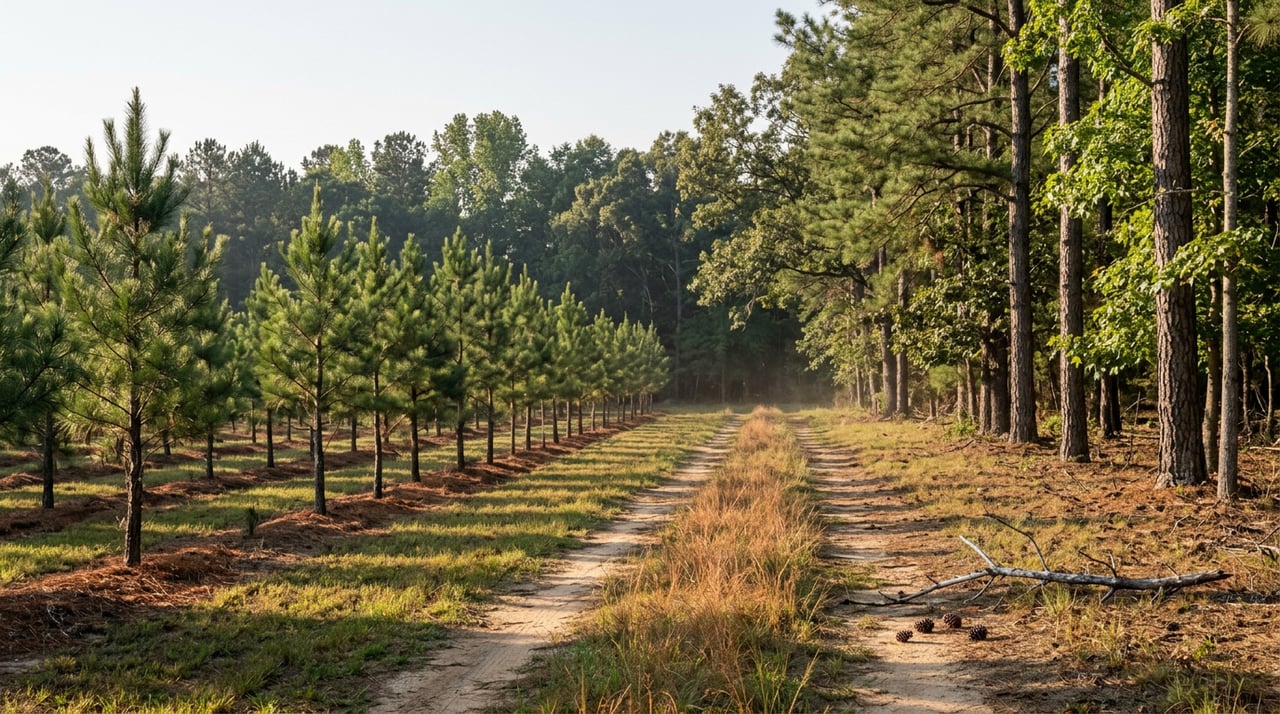
What happened next is the part that still matters to a buyer today. The federal government and private entrepreneurs recognized the reforestation potential in that abandoned land and acquired large acreages of it, rebuilding the forest partly through natural regrowth and partly through active pine planting. That's the origin of the pine woods you see marketed today as "wooded acreage" or "timbered privacy." It isn't untouched forest. It's a managed second-growth crop, planted and re-planted across parcel lines that were drawn for logging operations and land consolidation, not for homesites.
That's also why the acreage numbers on today's listings look so specific. A 44.79-acre tract or an 84-acre tract with a defined open-pasture portion usually traces back to how a much larger holding got carved apart, whether through a company's internal accounting of harvest blocks or through a later sale that split off a usable piece. Round numbers show up when a surveyor lays out a subdivision from scratch. Odd numbers show up when land gets divided along boundaries someone else already drew.
The Company That Still Owns the Woods Next Door
The reforestation didn't stop with a one-time replanting. Southeast Oklahoma's pine country became, and largely remains, working industrial timberland, and the largest name in that story is Weyerhaeuser. The company describes itself as one of the largest private landholders in the United States, holding more than 13 million acres nationally, over 9 million of them in the southeastern U.S., with a stated goal of maximizing the value of every acre it manages, whether through timber, minerals, or leased recreation.
That last part is worth sitting with. Weyerhaeuser doesn't sell most of its Oklahoma timberland to individual buyers. It leases it for hunting, fishing, and outdoor recreation, keeping ownership intact while generating income from the land in the meantime. Land near Haworth that looks, on a map, like it should be for sale is often just not on the market at all. It's under lease, accessible by a network of all-season roads the company controls through locked gates, and it will stay that way until the company decides otherwise.
Sometimes "otherwise" happens at a much larger scale than a single-family land sale, and the results directly border the parcels buyers are shopping today. In 1997, a land exchange between the U.S. Forest Service and Weyerhaeuser created what's now the Broken Bow Unit of the Ouachita Wildlife Management Area. The adjacent Tiak Unit, roughly 20,000 acres of mixed loblolly pine, hardwood, and mature bottomland forest, sits southeast of Idabel surrounding the towns of Haworth and Tom. If your prospective tract backs up to public wildlife management land, that boundary line exists because of a corporate-to-federal transaction, not because a park was carved out of the countryside for conservation's own sake. It's a useful amenity, giving you effectively free access to thousands of additional acres for hunting and hiking, but it also means public hunters share your fence line during deer and turkey season.
What "Unrestricted" Is Actually Telling You
Once you understand the ownership history, the word "unrestricted" reads differently. It doesn't mean freedom from rules in some general sense. It means the parcel was never platted as a residential subdivision with recorded covenants, setbacks, or an architectural review process. That's exactly what you'd expect from land that spent decades as forestry inventory rather than housing stock.
For a buyer, that cuts two ways. There's no HOA dictating what you can build or how your neighbor's place has to look, which is part of the appeal for people drawn to Haworth's privacy in the first place. But there's also no built-in mechanism protecting the character of what gets built around you later, and no guarantee that a company-drawn boundary lines up cleanly with usable road access or utility availability. "Unrestricted" is a true statement about the deed. It is not a substitute for checking access, easements, and any timber or mineral reservations a previous corporate owner may have retained when the parcel was sold.
A Live Example: The Plantation Planted Last Year
The clearest evidence that this is still an active industry, not a historical footnote, is the Pine Creek Tree Plantation near Tom, Oklahoma, just outside Haworth. It's being marketed in both 40-acre and 80-acre tracts as a professionally managed timber farm, planted in 2023 with loblolly pine seedlings alongside oak trees intended to support wildlife. This is the same reforestation logic the Oklahoma Historical Society describes from a century ago, just running its current cycle. Someone planted this ground deliberately, on a timeline measured in decades rather than seasons, and is now selling smaller pieces of it to buyers who want either a long-term timber investment or a wooded tract with a documented planting history.
That's a genuinely different purchase than raw, never-managed woods. A 2023 planting means the trees on that land are three years into a growth cycle that runs far longer before any timber income shows up, so anyone buying it as an investment needs to think in terms of a multi-decade hold, not a quick return. Anyone buying it for personal use gets young, uniform pine rather than the mixed, mature forest you'd find on an older, unmanaged parcel nearby.
What This Means When You Compare Haworth to Other Towns
McCurtain County is the third-largest county in Oklahoma by land area, and its timberland market reflects that scale at the top end. Recent county-wide timberland listings have totaled nearly 4,000 acres with a combined market value of close to $17 million, an average around $2 million per listing, which tells you those transactions are institutional in size, not the kind of tract a family buys for a cabin site.
The market immediately around Haworth looks nothing like that. As of this September, land listings there run smaller and far more residential in scale: around two dozen properties on the market, with an average list price near $311,000 and an average cost per acre around $5,460. That gap between the county's institutional timberland average and Haworth's smaller, buyer-facing listings isn't a contradiction. It's the same pattern this whole piece describes: a small share of what was once industrial forestland gets periodically released in parcels sized for individual buyers, while the bulk stays under corporate ownership, leased out rather than sold.
Before you make an offer on acreage near Haworth, a few questions are worth asking that a standard listing sheet won't answer on its own:
- Does the title work or the seller's history indicate this parcel was once part of a larger timber company holding, and if so, were any mineral or timber rights reserved when it was sold off?
- Is the land bordered by Ouachita WMA, Red Slough, or another public tract, and if so, are you comfortable with public hunting access along that boundary during season?
- If the tract includes planted pine, how old is the stand, and does that timeline match what you actually want from the land, whether that's privacy now or timber income decades from now?
- Does "unrestricted" mean there's no covenant structure at all, or does the deed carry an older easement or reservation from a prior corporate owner that a title search will surface?
None of these questions show up in a standard listing description. They're the kind of thing you only know to ask once you understand how this particular stretch of Oklahoma got to be forested in the first place, and why so much of it still isn't fully yours to divide the moment you close.
If you're weighing acreage near Haworth against other McCurtain County towns, or trying to make sense of a specific listing's history before you write an offer, Teresa Bartlett can walk the parcel history with you and help you understand exactly what you'd be buying into. Let's Connect.
